How Far Out Are Florida’s State Waters?
It’s a common scenario: you’re out on the water, the sun is shining, the fish are biting, and suddenly a little voice in the back of your head whispers, "Wait, am I even allowed to be fishing for this here? Am I still in Florida's state waters, or have I unknowingly ventured into federal territory?" This isn't just an idle thought; understanding the demarcation between state and federal waters is absolutely critical for any angler in the Sunshine State, as the rules for licenses, bag limits, and even the types of fish you can keep can change dramatically the moment you cross an invisible line. This guide is here to clear up that confusion, explaining exactly where Florida's state waters end and why knowing this line in the sand (or, more accurately, in the water) is so important for a successful and legal fishing trip.
Understanding Florida's State Waters: Why It Matters to Anglers
Florida boasts an incredible amount of coastline, and with that comes a complex patchwork of fishing regulations. Many anglers, especially those new to the state or just visiting, often assume that if they're still within sight of land, they're fine. Unfortunately, that's not always the case, and operating under such an assumption can lead to hefty fines, confiscated gear, and a really bad day on the water. Knowing where state waters end is the first step in ensuring you're compliant with all the necessary rules, which ultimately helps protect our valuable marine resources for generations to come.
The Crucial Difference: State vs. Federal Regulations
The most significant reason to understand these boundaries lies in the regulations themselves. State agencies, primarily the Florida Fish and Wildlife Conservation Commission (FWC), set the rules for fishing within state waters. These rules cover everything from minimum and maximum size limits for popular species like snook and redfish, to daily bag limits, and even seasonal closures. However, once you venture beyond Florida's state water boundaries and into federal waters, a whole new set of rules kicks in, governed by federal agencies like the National Oceanic and Atmospheric Administration (NOAA) Fisheries and the Gulf of Mexico Fishery Management Council (for the Gulf side) or the South Atlantic Fishery Management Council (for the Atlantic side).
For example, a species like Red Snapper might have a short, specific season in federal waters, while in state waters, it could be closed entirely or have different dates. The same goes for certain species of grouper or even some pelagic species. It's not uncommon for state and federal regulations to differ wildly for the same species, creating a real headache for anglers if they're not prepared. You might be perfectly legal to possess a certain fish in state waters, only to be in violation once you cross into federal territory. This divergence in rules is a major source of frustration for many, but it's a reality every Florida angler must contend with. You can dive deeper into these rules by checking out Florida Fishing Regulations and Bag Limits.
Enforcement and Consequences of Crossing the Line
Imagine you’re having a fantastic day offshore, reeling in some impressive fish, only to be approached by a law enforcement vessel. The officers aren't just looking for your Florida Fishing License Guide; they're also checking your catch against both state and federal regulations, and they know exactly where you are on the water. Both state FWC officers and federal agents from NOAA Fisheries patrol these waters, and they have the authority to enforce their respective jurisdictions' laws.
The consequences of violating federal fishing regulations can be much more severe than state violations. Fines can be substantially higher, your boat and gear could be seized, and in some extreme cases, you might even face criminal charges. It's not a risk worth taking, especially when a little knowledge can prevent a lot of heartache. This is why having reliable navigation equipment that clearly shows these lines is not just a convenience, but a necessity for anyone venturing offshore.
Defining the Lines: Specific Boundaries for Florida's State Waters
So, where exactly are these invisible lines? The answer depends on which coast of Florida you're on, which adds another layer of complexity for anglers. Florida has two distinct maritime boundaries that anglers need to be aware of: one for the Atlantic Ocean and one for the Gulf of Mexico.
Florida's Atlantic Coast State Waters
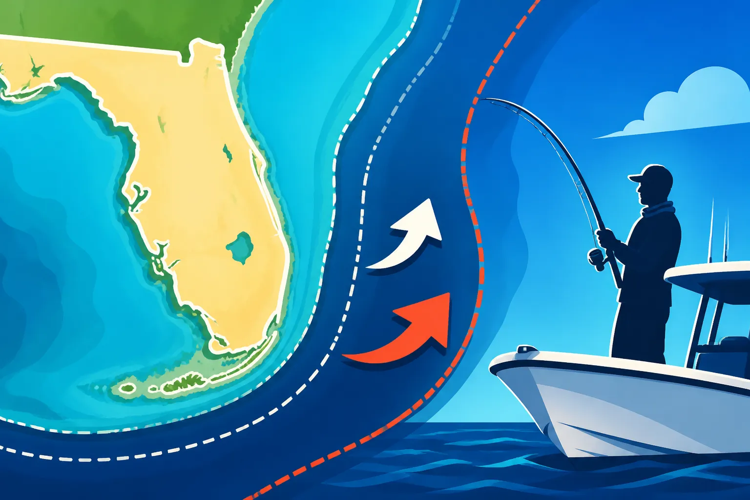
For the Atlantic side of Florida, the boundary for state waters extends three nautical miles from the coastline. This means that if you launch your boat from a ramp in Jacksonville, Fort Lauderdale, or Miami and head east into the Atlantic, you are in state waters for the first three nautical miles. Once you push past that three-nautical-mile mark, you are officially in federal waters.
This 3-mile rule is pretty standard for many states along the Atlantic seaboard. It's relatively easy to remember, but it still requires accurate navigation to ensure you don't inadvertently cross the line if you're targeting federally managed species. The Atlantic coast is home to fantastic fishing, from king mackerel to sailfish, many of which are regulated by federal rules once you pass that close-in boundary.
Florida's Gulf Coast State Waters
Things get a little different, and arguably more generous, on the Gulf of Mexico side of Florida. For Florida's Gulf Coast, the state water boundary stretches out nine nautical miles from the coastline. This wider buffer on the Gulf side is a result of historical legal agreements and geological differences, specifically related to oil and gas rights, but it translates directly to fishing regulations.
So, if you're fishing out of Pensacola, Tampa, or Naples and heading west into the Gulf, you're in Florida state waters for a full nine nautical miles. This larger expanse means that a significant amount of popular fishing grounds, including many nearshore reefs and wrecks, often fall entirely within state jurisdiction. This gives anglers a bit more leeway before they need to worry about federal regulations for certain species. However, even within this 9-mile range, you still need to pay close attention to Florida Saltwater Fishing License Rules and species-specific state limits.
What is a Nautical Mile Anyway?
When we talk about three or nine "nautical miles," it's easy to assume it's the same as a regular mile you see on a road sign, but that's not quite right. A nautical mile is a unit of measurement used in sea and air navigation, and it's slightly longer than a standard statute mile.
- One Nautical Mile (NM) is approximately 1.15 statute miles (or about 1.852 kilometers).
So, when the rules say three nautical miles, it means you've got about 3.45 statute miles before you hit federal waters on the Atlantic side. On the Gulf side, nine nautical miles translates to roughly 10.35 statute miles. Understanding this distinction is important because your boat's speedometer or even a basic GPS might display distances in statute miles, so it's good to be aware of the conversion. Most modern marine GPS units will allow you to select your preferred unit of measurement, so make sure it's set to nautical miles for clarity when referencing these boundaries.
Navigating Beyond State Lines: Entering Federal Waters
For many anglers, especially those targeting larger pelagic species or venturing further offshore for snapper and grouper, going into federal waters is a rite of passage. It opens up new fishing opportunities, but it also brings a heightened level of responsibility regarding compliance. It's not enough to just know the boundary; you need to understand the implications of crossing it.
Licenses and Permits for Federal Waters
Here's where it can get tricky. Generally, your base Florida Fishing License Guide (whether annual, 5-year, or a short-term option like a Florida 3-Day Nonresident Fishing License Cost) will cover your recreational fishing activities in both state and federal waters, as long as you are fishing recreationally and adhering to species-specific federal regulations. However, for certain highly regulated species, additional federal permits might be required, especially if you intend to harvest them.
For instance, while recreational anglers usually don't need a specific federal permit just to fish for most species in federal waters, commercial operations definitely do. And for highly migratory species like certain tunas, or for particular gear types, there can be federal registration or reporting requirements. It's always best to check the latest NOAA Fisheries guidelines for the specific region you'll be fishing (Gulf of Mexico or South Atlantic) to ensure you don't miss any obscure requirements. It's far better to spend a few minutes researching online than to find out the hard way that you needed something you didn't have.
Species-Specific Regulations in Federal Waters
This is arguably the most critical aspect of fishing in federal waters. For many popular offshore species, the federal rules diverge significantly from Florida's state rules. Take Red Snapper, for example, a highly prized fish in the Gulf of Mexico. The federal season for Red Snapper is often very short, sometimes only a few weeks, and usually has specific size and bag limits set by the Gulf of Mexico Fishery Management Council. In contrast, Florida might have different rules for Red Snapper caught within its 9-nautical-mile state waters.
The same applies to various grouper species, amberjack, and even some pelagic species. These regulations can change year-to-year or even mid-season, making it a constant challenge to stay informed. Many charter captains, like those operating on a Florida Fishing Charter Guide, stay incredibly current on these rules because their livelihood depends on it. For the recreational angler, it means being proactive about checking the FWC and NOAA Fisheries websites before every trip, especially when venturing offshore.
Tools and Technology for Staying in Bounds
In this day and age, there's no excuse for not knowing your location. Modern marine electronics have made it incredibly easy to identify where you are in relation to state and federal boundaries.
- GPS Chartplotters: These are your best friend offshore. High-quality units from brands like Garmin, Simrad, or Lowrance come preloaded with detailed charts that clearly mark state and federal water boundaries. You can even set alarms to notify you when you approach these lines. You can find a wide array of marine GPS units and updated electronic charts on platforms like Amazon, making it easier than ever to keep track of your position relative to these invisible lines.
- Marine Apps: Many smartphone and tablet apps offer marine charting capabilities that rival dedicated chartplotters. Apps like Navionics or C-MAP allow you to overlay fishing regulations, identify boundaries, and track your position in real-time. Just make sure your device is waterproof and has a reliable battery life or external power source.
- Paper Charts: Don't underestimate the value of a good old-fashioned paper chart as a backup. While not as dynamic as electronics, they provide a clear, reliable overview of the area and the boundaries.
Always ensure your charts, whether electronic or paper, are up-to-date. Boundaries don't change, but regulatory information overlaid on digital charts often gets updated.
Practical Tips for Anglers: Staying Compliant and Safe
Knowing the theoretical boundaries is one thing, but consistently applying that knowledge in real-world fishing scenarios is another. Here are some practical tips to help you stay compliant and safe when navigating Florida's state and federal waters.
Always Check Current Regulations
I know it sounds repetitive, but this cannot be stressed enough: regulations change. They change annually, sometimes seasonally, and occasionally even mid-year in response to stock assessments or management decisions. What was legal last year might not be legal today. Before every fishing trip, especially if you plan to go offshore, dedicate a few minutes to check the latest rules.
- FWC Website: For state waters (0-3 NM Atlantic, 0-9 NM Gulf).
- NOAA Fisheries Website: For federal waters (beyond 3 NM Atlantic, beyond 9 NM Gulf).
- Fishing Apps: Many apps like FishRules or Florida FWC's own app provide real-time updates on regulations based on your GPS location. While incredibly helpful, always cross-reference with the official government sites when in doubt.
- Local Bait Shops and Guides: These folks are often the first to know about changes and can provide invaluable local insights.
Ignoring this step is like driving without checking the speed limit signs. Ignorance of the law is never a valid defense.
Using Marine Charts and GPS Effectively
Having the tools is only half the battle; knowing how to use them is essential.
- Mark Boundaries: On your GPS chartplotter, create custom waypoints or zones that clearly delineate the state/federal water boundaries. This visual aid will make it much easier to see at a glance if you're approaching or have crossed the line.
- Set Alarms: Most modern GPS units allow you to set proximity alarms. Configure an alarm to sound when you are, say, a quarter-nautical mile from the federal boundary. This gives you ample warning to adjust your course or fishing strategy.
- Understand Your Drift: Even if you motor out to a spot in state waters, current and wind can slowly drift you into federal territory without you even realizing it. Keep an eye on your GPS and your position relative to the boundaries throughout the day. This is especially important when drift fishing or anchoring in strong currents.
| Feature | Florida State Waters (Atlantic) | Florida State Waters (Gulf) | Federal Waters (Atlantic & Gulf) |
|---|---|---|---|
| Distance from Shore | 0 to 3 Nautical Miles | 0 to 9 Nautical Miles | Beyond 3 NM (Atlantic), Beyond 9 NM (Gulf) |
| Governing Authority | Florida Fish and Wildlife Conservation Commission (FWC) | Florida Fish and Wildlife Conservation Commission (FWC) | National Oceanic and Atmospheric Administration (NOAA) Fisheries, Regional Councils |
| General Rule Complexity | Generally simpler, more consistent | Generally simpler, more consistent | Often complex, species-specific, highly dynamic seasons/limits |
| License Requirement | Florida Fishing License | Florida Fishing License | Florida Fishing License (for recreational, non-commercial) |
| Permits Required | Rare, species-specific (e.g., Florida Snook Permit Requirements) | Rare, species-specific (e.g., Florida Lobster Permit Requirements) | May require federal permits for certain species/activities (e.g., highly migratory species, commercial) |
| Enforcement | FWC Officers | FWC Officers | NOAA Law Enforcement, U.S. Coast Guard |
When in Doubt, Hire a Guide
If all of this sounds like too much to keep track of, or if you're visiting Florida and want to ensure a stress-free trip, consider hiring a licensed fishing guide or charter captain. These professionals make it their business to know the boundaries, the regulations, and where the fish are biting, all while keeping you within the bounds of the law.
They also provide all the necessary safety equipment and typically cover the vessel's fishing license, meaning you often don't need your own individual license when fishing on a licensed charter. A good guide can teach you Florida Inshore Fishing Techniques or Florida Offshore Fishing Techniques and ensure you have an enjoyable and compliant experience. Plus, they can take you to the best spots for Best Time of Year to Fish in Florida and help you land that trophy catch you've been dreaming of without any legal worries.
Understanding "how far out are Florida's state waters" isn't just a technicality; it's a fundamental piece of knowledge that safeguards your fishing experience and contributes to the conservation efforts that keep Florida's fisheries thriving. Do your homework, use your tools, and when in doubt, get guidance from the experts or officials. Tight lines!
Disclaimer
This article is for general informational purposes only and does not constitute professional advice. Laws, prices and regulations vary by location and change over time. Consult a qualified professional for guidance on your specific situation.