How to Read a Tide Chart for Fishing
Oh, the age-old dilemma: you head out to your favorite fishing spot, convinced it's going to be a banner day, only to find the water is like a glass pond with not a single bite. Or maybe the current is ripping so hard your bait can't even get down. More often than not, the culprit is misunderstanding the tides. It's a frustrating experience that can make you feel like you're missing a secret code. But don't worry, friend; this guide is here to unravel that mystery and teach you exactly how to read a tide chart for fishing, transforming your hit-or-miss outings into much more strategic and successful adventures, especially here in Florida.
Understanding the Basics of Tides in Florida
Before we dive into the nitty-gritty of reading a chart, it's really helpful to grasp what tides actually are and why they're such a big deal for us anglers in the Sunshine State. Tides are essentially the rise and fall of sea levels caused by the gravitational forces of the moon and the sun on the Earth's oceans. Think of it like a giant, invisible hand pulling the water back and forth. This constant movement is a huge factor in how fish behave, where they feed, and ultimately, whether they'll even notice your bait.
The Forces Behind the Flow: Moon, Sun, and Earth
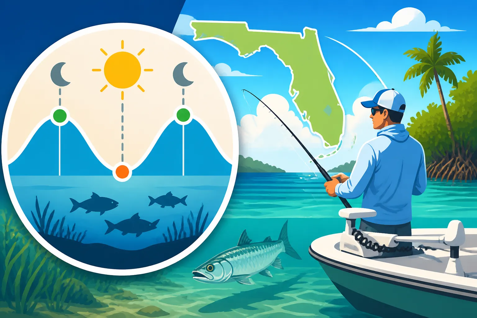
It might sound a bit like a science lesson, but understanding this fundamental concept makes tide charts far less intimidating. The moon, being closer to Earth, has the strongest gravitational pull on our oceans, causing two high tides and two low tides each day in most places. The sun also plays a role, either amplifying or dampening the moon's effect depending on its alignment. When the sun and moon are aligned (during new and full moons), their gravitational forces combine, leading to stronger "spring tides" with higher high tides and lower low tides. This means more dramatic water movement. When they are at right angles to each other (during quarter moons), their forces partially cancel out, resulting in weaker "neap tides" with less extreme highs and lows. Knowing this helps you anticipate the overall strength of the current, which is crucial for Best Tides for Inshore Fishing in Florida.
High Tide, Low Tide, and the All-Important Slack Tide
Every tide chart will show you the times for high tide and low tide. These are the peak and trough points of the water level. But for fishing, the movement of the water between these points is often more important.
- Incoming Tide (Flood Tide): This is when the water is rising from low tide to high tide. As the water pushes in, it often brings in baitfish, nutrients, and covers new feeding grounds for predatory fish.
- Outgoing Tide (Ebb Tide): This is when the water is falling from high tide to low tide. As the water recedes, it can funnel baitfish out of mangroves, creeks, and flats, concentrating them in channels and deeper areas, making them easier targets for hungry fish.
- Slack Tide: This is the period around the peak of high tide and the trough of low tide when the water movement is at its slowest, sometimes appearing almost still. Many anglers mistakenly think slack tide is bad, but it simply requires a different approach. Fish might move into deeper pockets or seek out structure during these calmer periods.
Florida's unique geography, with its extensive coastline, countless inlets, bays, and backcountry, means that tidal patterns can vary significantly from one region to another. A strong incoming tide in the Florida Keys might be quite different from an incoming tide in the Panhandle, or even in a large estuary like Tampa Bay.
Decoding the Tide Chart: What All Those Numbers Mean
Now that we've got the basics down, let's actually look at how to interpret one of these magical charts. They might look like a jumble of numbers and abbreviations at first glance, but once you know what you're looking for, they become incredibly powerful tools for planning your fishing trips.
Key Elements of a Standard Tide Chart
A typical tide chart, whether you pick up a local fishing newspaper, check an app on your phone, or find a handy waterproof guide on Amazon, will usually present information in a clear, tabular format. Here are the essential components you'll see:
- Date: Pretty self-explanatory! This tells you which day the predictions are for.
- Day of Week: Also straightforward, helps you plan around your schedule.
- Time: This is the crucial part. It indicates the exact predicted time of a high or low tide event. Times are typically shown in local time, sometimes with an AM/PM designation or 24-hour format.
- High/Low (or H/L): This column clearly labels whether the recorded time is for a High Tide or a Low Tide.
- Height (or Ft./M): This number indicates the predicted water level at that specific high or low tide. It's usually given in feet (ft.) in the US. A positive number means above a certain datum (average low water), and sometimes you might see negative numbers for extremely low tides, especially on charts with a different baseline.
Let's look at an example. Imagine a chart entry that says:DATE: Oct 26 DAY: Sat TIME: 04:15 AM H/L: L HEIGHT: 0.5 ftDATE: Oct 26 DAY: Sat TIME: 10:30 AM H/L: H HEIGHT: 2.8 ftDATE: Oct 26 DAY: Sat TIME: 04:40 PM H/L: L HEIGHT: 0.2 ftDATE: Oct 26 DAY: Sat TIME: 11:00 PM H/L: H HEIGHT: 3.1 ft
From this, you can quickly tell that on Saturday, October 26th, there will be two low tides (at 4:15 AM and 4:40 PM) and two high tides (at 10:30 AM and 11:00 PM). You can also see the predicted heights. The difference between the low and high tide heights (e.g., 2.8 – 0.5 = 2.3 feet for the morning cycle) indicates the "tidal range," which gives you a sense of how much water will move. A larger range usually means stronger currents.
Interpreting Incoming, Outgoing, and Slack Water Periods
The real trick is using these peak times to figure out when the water is moving.
- Incoming Tide: This occurs between a low tide and the subsequent high tide. So, from 4:15 AM to 10:30 AM on our example chart, the water will be steadily rising – that's your incoming tide.
- Outgoing Tide: This occurs between a high tide and the subsequent low tide. From 10:30 AM to 4:40 PM, the water will be falling – your outgoing tide.
- Slack Water: This is the tricky one. Slack water doesn't happen exactly at the published high or low tide times. It usually occurs for about 30 minutes to an hour around those peaks. So, for the 10:30 AM high tide, expect slack water from roughly 10:00 AM to 11:00 AM. For the 4:40 PM low tide, it might be slacker from 4:10 PM to 5:10 PM. This is an approximation and can vary greatly depending on the location and specific geography (narrow inlets tend to have stronger, shorter slack tides, while large open bays might have longer, less noticeable slack periods).
Here’s a simplified table to help you visualize:
| Tide Event | Predicted Time | Description | Fishing Implication |
|---|---|---|---|
| Low Tide | 4:15 AM | Lowest water level. | Water starts rising after this; good for sight fishing at the very start of the flood. |
| Incoming Tide | 4:15 AM – 10:30 AM | Water rising, current flowing in. | Often prime feeding time as bait moves in. Fish push onto flats. |
| High Tide | 10:30 AM | Highest water level. | Slack water period around this time. Water starts falling after. |
| Outgoing Tide | 10:30 AM – 4:40 PM | Water falling, current flowing out. | Bait gets flushed out of cover. Fish ambush points along channels and structure. |
| Low Tide | 4:40 PM | Lowest water level. | Another slack period, then water begins to rise again. |
Keep in mind that tide charts are predictions, and local conditions like strong winds can dramatically influence actual water levels and current flow. Some fishing apps are excellent for real-time data, but knowing how to read the base chart is always the first step.
Applying Tide Chart Knowledge to Your Florida Fishing Strategy
This is where the rubber meets the road! Knowing how to read the chart is one thing, but knowing how to use that information to catch more fish is the real goal. Florida's diverse fisheries, from the flats of the Gulf Coast to the inlets of the Atlantic, are heavily influenced by tidal movement.
Fishing the Incoming Tide: A Rush of Opportunity
Many of Florida's most sought-after inshore species, like snook and redfish, absolutely love an incoming tide. As the water floods into the shallow flats, mangrove shorelines, and oyster bars, it brings with it a fresh supply of baitfish, shrimp, and crabs that have been hiding in deeper water. This is when predators get active and push into these newly accessible areas to feed.
- Target Species: Snook, Redfish, Tarpon (in certain areas), Spotted Seatrout, Flounder (sometimes).
- Why It Works: The rising water provides cover and access to new foraging grounds. Baitfish get disoriented and swept in, making them easy targets. The water can also be clearer, especially after a low tide has pulled out murky water from creeks.
- Where to Fish:
- Mangrove Edges: Fish will patrol these lines, waiting to ambush bait.
- Grass Flats: As the water rises, snook and redfish will cruise over these flats. This is ideal for Sight Fishing Technique for Shallow Flats if the water is clear.
- Inlets and Passes: Fish stage in these areas, waiting for bait to be pushed in.
- Oyster Bars: These structures become prime ambush points as water covers them.
When the tide is coming in, I often prefer to cast live bait like pilchards or shrimp right up against the mangroves or work a weedless soft plastic lure across the grass. Remember, if you're fishing areas that require a license, make sure you understand the Florida Saltwater Fishing License Rules to avoid any issues.
Fishing the Outgoing Tide: Funneling the Feast
Just as the incoming tide brings in the buffet, the outgoing tide often funnels it out, creating another fantastic fishing scenario. As the water drains from the flats and backcountry, it forces baitfish and crustaceans out of their hiding spots and into more concentrated areas like channels, creek mouths, and deeper pockets.
- Target Species: Redfish, Flounder, Spotted Seatrout, Snook, Ladyfish, Jack Crevalle.
- Why It Works: The receding water acts like a conveyor belt, pushing food directly to waiting predators. Fish will position themselves strategically to intercept this outflow.
- Where to Fish:
- Creek Mouths and Drains: These are classic ambush spots as bait washes out.
- Channel Edges: Fish will lie in wait along the deeper edges of channels.
- Bridges and Docks: Structure provides excellent cover and current breaks where fish can hide and ambush. This is particularly true for trout at night when using How to Fish a Dock at Night for Trout.
- Shallow Flats with Potholes: As water drops, fish often retreat to these deeper depressions.
For an outgoing tide, I might use a jig and soft plastic to probe the bottom of channels or cast a live shrimp near a creek mouth. Knowing How to Fish an Outgoing Tide effectively can dramatically improve your chances, especially in backcountry areas.
Navigating the Slack Tide: Patience and Precision
Slack tide, the period of minimal water movement around high and low tide, often gets a bad rap from anglers. It's true that the bite can slow down considerably when there's no current to move bait. However, it's not a time to pack up and go home! It simply calls for a different strategy.
- Target Species: Grouper, Snapper (especially Mangrove Snapper), Sheepshead, Black Drum, Catfish. Bass in freshwater systems are not affected by ocean tides, of course, but current can still influence them in rivers.
- Why It Works: With less current, fish might move off aggressive ambush points and seek deeper, calmer water or hold tighter to structure. They're still feeding, but often require a slower, more precise presentation.
- Where to Fish:
- Deeper Holes and Channels: Fish might congregate here, waiting for the current to pick up again.
- Heavy Structure: Wrecks, reefs, bridge pilings, and rock piles offer excellent cover during slack water.
- Docks and Piers: These can be productive any time, but especially during slack tide when fish are seeking cover.
During slack tide, consider switching to bottom fishing techniques with cut bait or slow-moving artificials. A perfectly placed weighted shrimp or crab imitation can still entice a bite from a snook or snapper tucked away near structure. It's often about enticing a bite rather than relying on an aggressive feeding frenzy.
Beyond the Basics: Other Factors to Consider with Tides
While mastering the tide chart is a huge step, it's important to remember that it's just one piece of the puzzle. Florida fishing is a complex dance between many environmental factors. Integrating your tide knowledge with other observations will make you an even more formidable angler.
The Moon's Influence: Spring and Neap Tides
We touched on this earlier, but it bears repeating: the moon phase directly impacts the strength of the tides.
- New Moon and Full Moon (Spring Tides): These are the times of the strongest tidal pulls. You'll see larger differences between high and low tide heights on your chart. This translates to stronger currents and often more aggressive feeding windows. If you're looking for a powerful bite, these are typically your best bets, though the strong current can also make fishing challenging.
- First and Last Quarter Moon (Neap Tides): During these phases, the gravitational forces are less aligned, resulting in weaker tides with smaller height differences. The currents will be less intense, and fish might spread out more, or the bite might be more subtle.
Understanding this will help you anticipate not just when the tide will move, but how vigorously it will move. Sometimes a strong spring tide current is exactly what you want for active predators, while a gentler neap tide might be better for presenting bait to more finicky fish. You can often find fishing calendars that incorporate moon phases, sometimes available on Amazon.
The Wind Factor: A Game Changer
Here in Florida, wind can be as influential as the tide, sometimes even more so! A strong wind blowing against the predicted tidal flow can either dampen its effects or even completely override them.
- Wind Against Tide: If you have a strong easterly wind blowing into a bay during an outgoing tide, it can hold the water in, reducing the predicted drop in height and weakening the outgoing current. This can make the fishing slow because the bait isn't being flushed out as expected.
- Wind With Tide: Conversely, a strong westerly wind pushing water out of a bay during an outgoing tide can exaggerate the low tide, exposing more bottom than usual and creating an even stronger current. This might concentrate fish, but also make it tough to present bait.
Always check the wind forecast alongside your tide chart. A little mental arithmetic to combine these factors will help you choose the best spots. For instance, if you're trying to fish a shallow flat on an incoming tide, and there's a strong wind blowing out of the flat, it might completely counteract the incoming tide, leaving you with stagnant water. Keep an eye on the wind, and don't be afraid to adjust your plans.
The "Micro" Tides: Local Geography and Your Specific Spot
Tide charts provide predictions for specific geographic reference points, like an inlet or a major port. However, the actual tide in your exact fishing spot might be slightly different.
- Time Lag: If you're fishing deep inside a bay or up a river, the tide might "lag" behind the published times for the inlet. It takes time for the water to push its way in or out. This lag can be anywhere from 15 minutes to several hours, depending on how far you are from the main tidal station.
- Current Strength: Similarly, the strength of the current can vary. A narrow choke point will have a much faster current than a wide, open bay, even if the overall tidal range is the same.
Experience is your best teacher here. Pay attention to how the water actually moves at your favorite spots in relation to the published tide charts. Over time, you'll develop an intuitive sense of these local anomalies. Don't be afraid to consult local bait shops or seasoned captains; they often have a wealth of knowledge about their specific fishing grounds and can offer insights into Best Fishing Spots in Florida. Remember, the goal is to use the tide chart as a guide, not as an unyielding law. Combine it with your own observations and you'll be well on your way to more productive days on the water!
Disclaimer
This article is for general informational purposes only and does not constitute professional advice. Laws, prices and regulations vary by location and change over time. Consult a qualified professional for guidance on your specific situation.